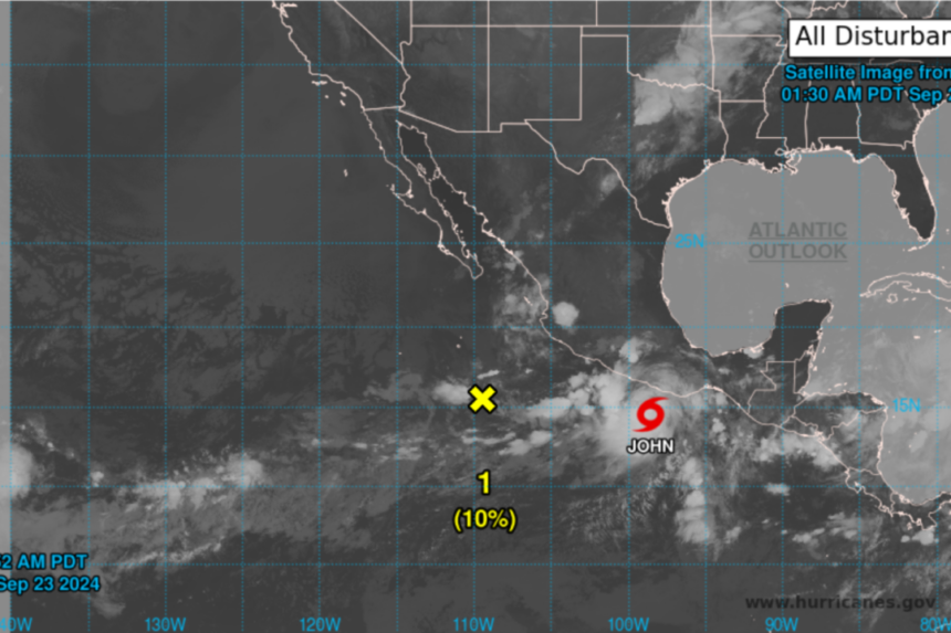
Tropical Storm John has developed in the eastern Pacific Ocean and is expected to bring heavy rainfall to southern Mexico later this week.
As of early Monday, the storm had winds of 65 kph (40 mph) and was located approximately 240 kilometers (150 miles) south of Punta Maldonado, Mexico.
The Mexican government has issued a hurricane watch and a tropical storm warning for the coast from Punta Maldonado to Bahias de Huatulco.
A hurricane watch indicates that tropical storm conditions, with sustained winds of 63 to 117 kph (39 to 73 mph), may occur in the area within the next 48 hours.
According to the National Hurricane Center in Miami, Tropical Storm John is currently nearly stationary but is expected to move closer to the southern Mexico coast by Tuesday and Wednesday. The storm is forecasted to strengthen before making landfall.
From now until Thursday, John is projected to bring 15 to 30 centimeters (6 to 12 inches) of rain to coastal areas of Chiapas state, with higher amounts in isolated areas. Areas along the Oaxaca coast to southeast Guerrero can expect between 25 and 50 centimeters (10 and 20 inches) of rain, with isolated higher totals through Thursday.


